Monitor water levels for your coastal photography with the My Tide Times app
Keep an eye on changing water levels for your coastal photography – and personal safety – with My Tide Times
Photography project inspiration
• How to photograph coastal seascapes
Seascape shopping list
• Best cameras for landscapes
• Best lenses for landscapes
• Best tripod for photographers
• Best camera bag for travel
Watch video: Monitor water levels for your coastal photography
The weather isn’t your only environmental consideration when shooting a seascape, as tides can be an equally important factor. The position of the sea can impact your composition and what you’re able to shoot; if you’re planning to use rock pools as foreground interest, for example, you’ll need to shoot at low tide, but if you want your subject surrounded by water then you might have to wait until it rises.
This isn’t just about photography, either. For safety reasons, anybody visiting the coast should be aware of tidal conditions, as water levels can change surprisingly quickly and differ from day to day. You certainly don’t want to have to abandon your camera kit as you rush for higher ground!
• Read more: 5 essential apps for photographers
Photographers are particularly susceptible to shifting tides, as it’s all too easy to ignore your surroundings while you focus on capturing the perfect shot. Simply put, researching tides could save your life. The BBC’s tide tables are a great place to start and can be found online, but if you’re out in the field an app like My Tide Times is a useful asset.
According to the developer: “The app uses information from the UKHO (UK Hydrographic Office),” but it isn’t just limited to use in the UK – it contains tidal information for over 40 countries. It features plenty of additional information that’s of use to photographers, like the moon phase, and times for sunrise and sunset, too.
How to use the My Tide Times app
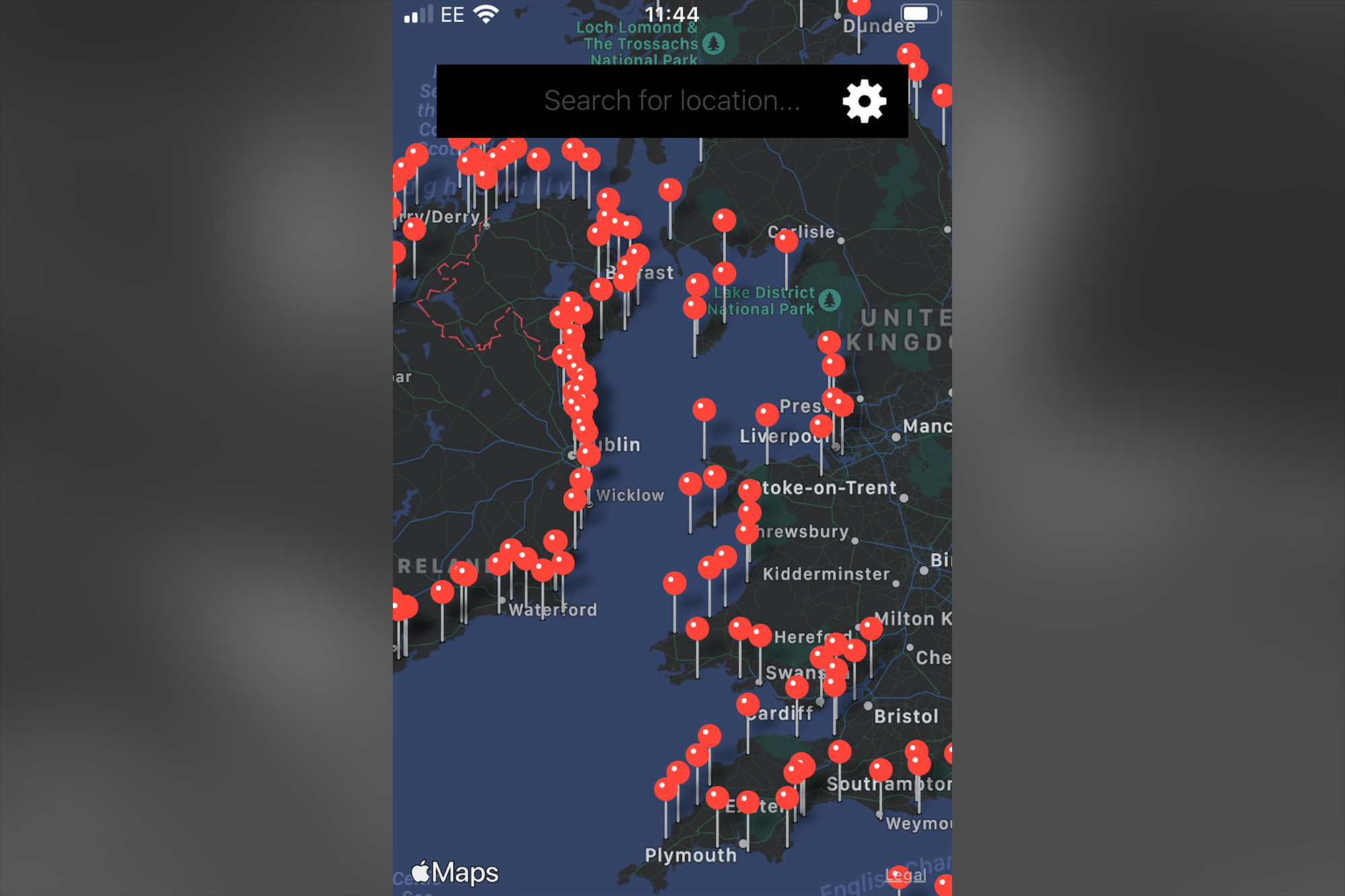
1. Nationwide tides
My Tide Times isn’t just useful in the UK – it works in over 40 countries, and the app's main interface is a surprisingly detailed map of the world. Red markers are present along coastlines that can be selected to reveal a plethora of information on that specific location.
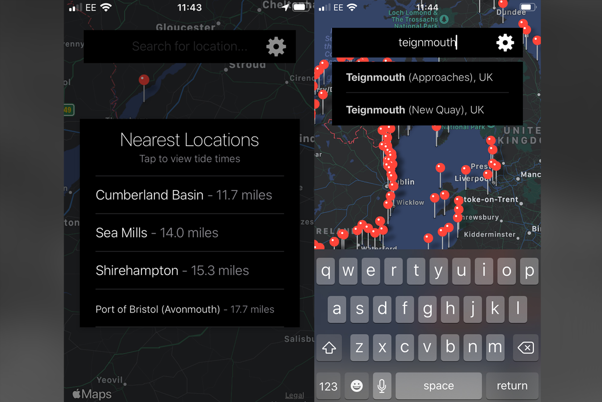
2. Set your location
To find a location you can use the search bar or scroll around and zoom into the map to find places manually. You can also allow the app to track your location so that it will send you a list of the nearest tidal spots, which you can select to retrieve data quickly.
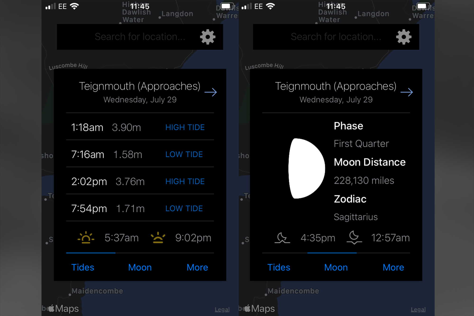
3. Information overload
Once you’ve selected a location, you’re presented with a plethora of information – including times and depths for low and high tide, as well as the moon phase, its distance and the zodiac sign. It even tells you when the sun and moon will each rise and set.
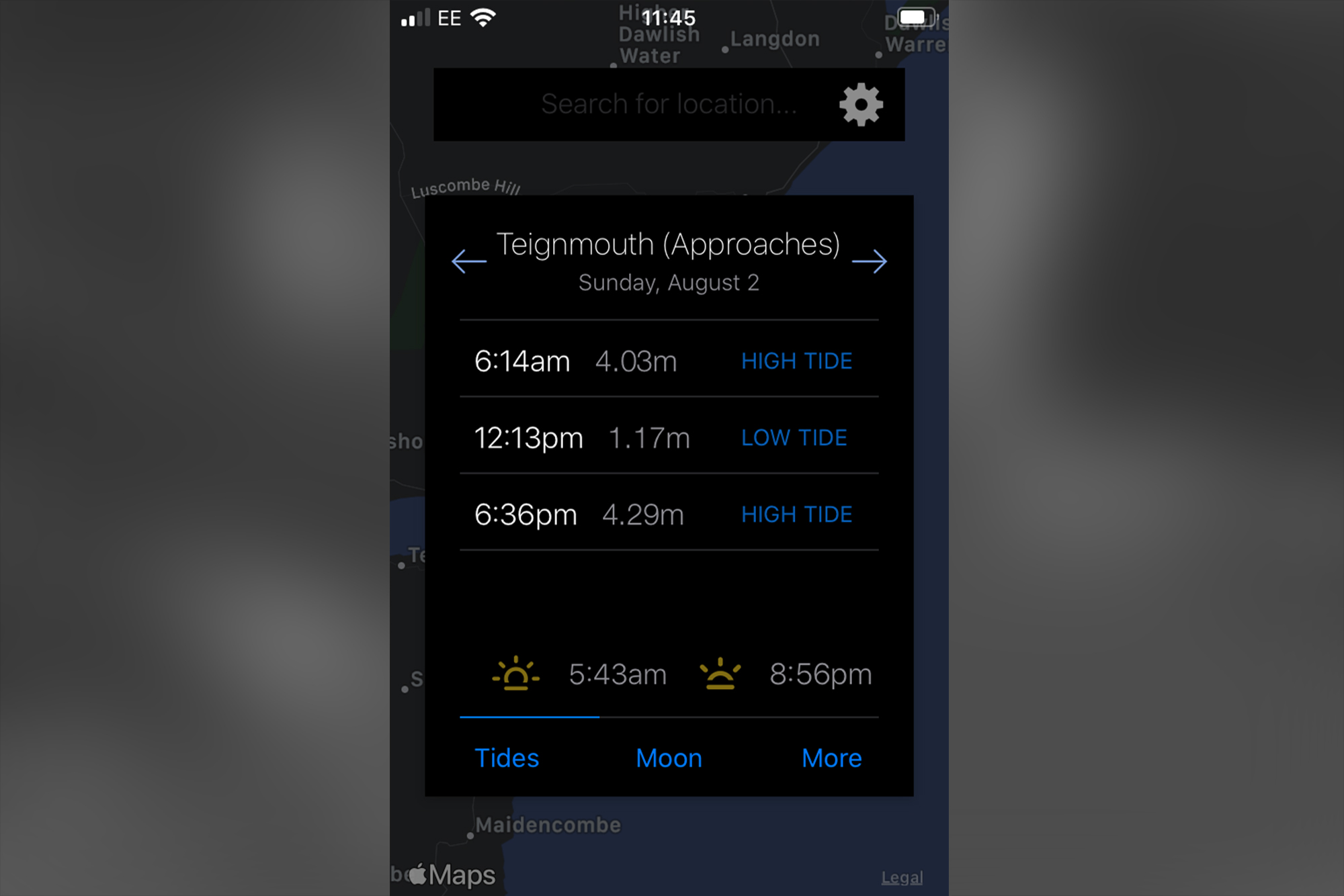
4. Planning ahead
You can access future predictions via the arrows either side of the location name, and the data will change accordingly. The UK doesn’t allow predictions as far in advance as other countries – which, according to the developer, is to comply with UKHO rules.
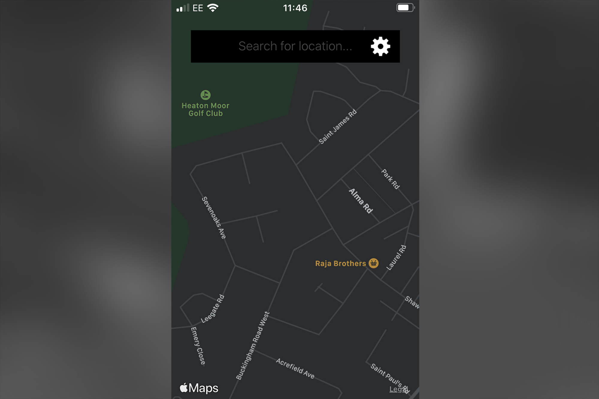
5. Mapped out
Although My Tide Times probably won’t replace the more detailed map-related apps you have on your smart device, you’ll find a surprising amount of detail when you zoom in on the digital map. It details settlements, roads and even a few places of interest, which is certainly useful in a pinch. You’ll even find tidal information for major bodies of water that travel inland, like the Thames and River Severn.
N-Photo: The Nikon Magazine is a monthly publication that's entirely dedicated to Nikon users. For the best news, reviews, projects and more, subscribe to N-Photo today!
Read more:
The best tripod for photographers
Best cameras for landscape photography
The best camera bag for travel
Get the Digital Camera World Newsletter
The best camera deals, reviews, product advice, and unmissable photography news, direct to your inbox!

Mike is Digital Camera World's How To Editor. He has over a decade of experience, writing for some of the biggest specialist publications including Digital Camera, Digital Photographer and PhotoPlus: The Canon Magazine. Prior to DCW, Mike was Deputy Editor of N-Photo: The Nikon Magazine and Production Editor at Wex Photo Video, where he sharpened his skills in both the stills and videography spheres. While he's an avid motorsport photographer, his skills extend to every genre of photography – making him one of Digital Camera World's top tutors for techniques on cameras, lenses, tripods, filters and other imaging equipment – as well as sharing his expertise on shooting everything from portraits and landscapes to abstracts and architecture to wildlife and, yes, fast things going around race tracks...

